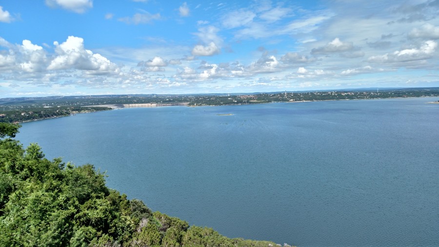
An afternoon spent boating with your family, riding the blue waters on a wake board, scuba diving down to the depths, sailing and watching the sun go down — these are all favorite pastimes of our beloved Lake Travis.
As the biggest water reservoir of the Highland Lakes, Lake Travis boasts activities for people of all lifestyles, and has served as home to thousands of Texans for the last century.
Residents are drawn to the open waters and the quieter pace of life that West Austin has to offer, but it’s easy to forget just how much our landscape has changed over the years … and just how much work went into creating our beloved Lake Travis.
The time was the turn of the century.
Austin was on the cusp of certain anticipated technological progress, and this included the use of dams to harness the area’s flooding rain waters for the purpose of hydroelectric power.
At the time, the land and lake that we call Lake Travis was but a big dream of big men. Senator Lyndon B. Johnson was at the forefront of the fight for hydroelectric power and the building of the seven dams that would eventually create the Highland Lakes of Central Texas.
Great floods in our area of Lake Travis seem like a distant dream to residents now, but during the early 1900s the picture was a little different. In fact, during the years of 1900-1913, there were over 17 major floods in Austin, claiming the lives of dozens of farmers in Matagorda and Wharton counties — not to mention millions of dollars worth of damage to fertile farmlands south of Austin.
Clearly, something needed to be done to contain the floods, these “walls” of water that would come down on farm sites with such ferocity that entire flocks of livestock would be carried away with it.
The damage was extreme, to say the least.
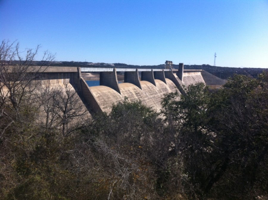
The History of Mansfield Dam
The story of Lake Travis starts in 1935 with one of the greatest floods ever to hit Austin.
It was summer in June when the waters rained down, hard enough to pour through Congress St. and into area restaurants such as the original Night Hawk. The floods in Austin and Central Texas had been devastating enough; it was time for a solution to all of the losses accrued during the early part of last century.
In December 1936, the United States Department of the Interior authorized the creation of the Lower Colorado River Authority, and with it the power to tame the floods of the area. It was decided that a “low dam” would be constructed at the Marshall Ford site for a 190-foot dam. This would later be raised to 265 feet for a higher dam, due to another catastrophic flood that happened in late July of 1938.
It was two years after the creation of the first of the Highland Lakes dams, Austin Dam on Lake Austin, when construction was finished on Marshall Ford Dam. On August 25, 1942, it was dedicated and later renamed Mansfield Dam, after J.J. Mansfield, the United States Representative who worked years to get the dam built.
Another figure that was very instrumental in securing the federal funding for the construction projects that erected the dam was a young and industrious Senator at the time, Lyndon Baines Johnson. He would go on to enact the Rural Electrification Act that would be the impetus for creating the Highland Lakes.
Geography of Lake Travis
Measuring in at 63.5 miles long, Lake Travis resides on the Colorado River and is the largest reservoir of all seven of the Highland Lakes. Its shape can best be described as “serpentine”, and starts in western Travis County and goes all the way into southern Burnet County to Max Starke Dam, which is southwest of Marble Falls.
Mansfield Dam is built across a deep canyon at Marshall Ford, which was a long-time river crossing before the dam was erected.
It may seem like a distant memory now, but early inhabitants of the Lake Travis area actually drove on a portion of RR 620 that went over the dam. However, as the area developed and traffic moved in, the city of Austin was forced to close that portion of the road in order to build the 4-lane highway that we use today.
On the other side of the dam is Lake Austin, which continues down through the city of Austin until it turns into Lady Bird Lake (formerly Town Lake).
Lake Travis — Now and Then
In the early 1900s, the Lake Travis area as we know it today was little more than a collection of farms and large swaths of undeveloped land. The urbanization that was seen across many places in the nation was yet to extend down to Central Texas.
Always standing in stark contrast to the “big city” vibe of downtown Austin, RR 620 was 20 miles from the city center … but it may as well have been a world away. The tracts of land that had been so dark under the evening skies would soon be boasting all manner of electrical endeavors and lights.
Times in Austin were changing, and as the promise of hydroelectric power materialized within the minds of Austinites, the time to build the dams that would be able to control the raging flood waters and power the city was now upon them.
There would be decades of legislation, preparation and construction before our Mansfield Dam was finally made and dedicated. However, the possibilities that now stood before the residents and business owners of Lake Travis were infinite.
These days, Lake Travis is exploding with development, business and community. As Austin grows, so do the towns surrounding it such as Lakeway, Bee Cave and Spicewood.
Lake Travis Recreation
The perfect locale to launch your boat for a warm Saturday afternoon spent out in the sun, it’s also known as the premier spot for lake recreation. This includes such favorite hobbies as sail boating, wake boarding, scuba diving, fishing and more.
Many area businesses rely on the waters of Lake Travis for their livelihood. Resorts on the lake have some of the best views around. Dozens of marinas call Lake Travis home, as do wedding venues and tourists spots.
For the outdoorsy types out there, there are campsites and Travis County parks to explore. Rent a boat for the afternoon and be home in time for the famous golden sunsets of the area.
The Future of Lake Travis
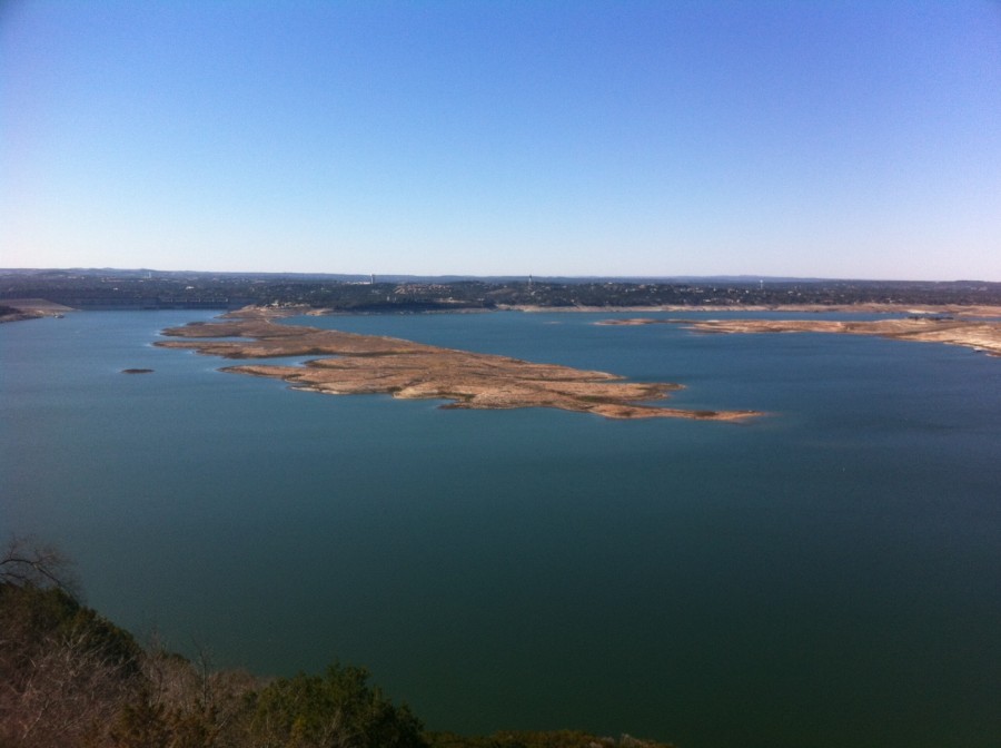
If you have been out by the blue waters of Lake Travis lately, you’ve likely noticed big changes in recent years.
Many new businesses are springing up in the surrounding area, many families are relocating to the area, and the development of Lake Travis master-planned communities including Steiner Ranch, Falconhead and Rough Hollow Lakeway are contributing to the exponential growth.
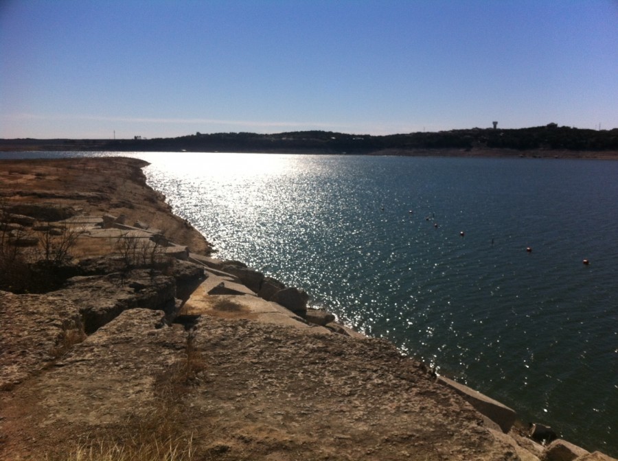
The drought combined with existing water demands is demonstrating that LCRA’s current water management plan is having a significant impact on the lake levels, water quality, and the regional economy.
Non-profit organizations like Central Texas Water Coalition have formed to address water issues of the Lower Colorado River Basin and advocate for the preservation and conservation of the Highland Lakes’ water supply and water levels.
It’s easy to forget about water conservation when Lake Travis is full, but times have changed and the future of our lakes and the area will depend on all of us getting and remaining involved with our most important natural resource — our water.
Facts about Lake Travis and Mansfield Dam:
- Mansfield Dam is 26 stories tall, and 7,098 feet long.
- Lake Travis can store up to 256 billion gallons of floodwater.
- The worst drought on record were the droughts of the 1940s and 1950s.
- The total cost to build Mansfield Dam was $28.7 million dollars.
- The dam is operated by the Corp of Engineers.
Bibliography:
Orum, Anthony M. Power, Money & the People: The Making of Modern Austin. Eugene, Or.: Resource Pub., 2002. 122+. Print.
“History of Lake Travis.” – Lake Travis Chamber of Commerce. N.p., n.d. Web. 16 Jan. 2014.
Breeding, Seth D. “LAKE TRAVIS.” Lake Travis. Texas State Historical Association, n.d. Web. 16 Jan. 2014.
“Mansfield Dam and Lake Travis.” Mansfield Dam and Lake Travis. Lower Colorado River Authority, n.d. Web. 17 Jan. 2014.


Perhaps a minor or even debatable point but you referred to Sen. Lyndon Johnson as being partially responsible for Mansfield Dam. In fact, it was Representative Lyndon Johnson who chanpioned the dam – later to become Senator, Vice-President, and President.
Thank you Tom! That is a good point … and good to know.
Great article! Praying that there wiil be a solution to saving water here in Austin.
Thanks Anne! And fortunately, we have a lot of people that have been praying for rain. Of course rain will help fill the lakes … but rain isn’t going to fix the problems with the water management and conservation of the Highland Lakes.
For right now, we do need a better solution to save the water we have here in Austin. If the lakes ever fill up again, we need a better plan to keep them that way.
The hearing at TCEQ (Texas Commission on Environmental Quality) on LCRA’s 2014 emergency order is today. LCRA will be requesting a trigger point of 1.1million acre feet before sending more water downstream. Firm water customers and those who support the Central Texas Water Coalition would like to see that trigger point increased to 1.4million acre feet minimum. This would be part of a solution to saving water here in Austin.
Pray for this solution to pass … and more prayers for solutions in the future!
I am curious what year the traffic was no longer allowed to cross the top of Mansfield dam.
I remember driving over it in the mid 70’s when I was at UT…